
Seskin [An Seisceann]
Good walks are even better shared.
Overview
A Journey to Seskin [An Seisceann]
Seskin, affectionately known as An Seisceann, stands proudly at 634 meters in the breathtaking Northwest Highlands of the UK. This Marilyn offers not just a memorable climb, but also a journey through time and terrain that will leave both amateur and seasoned hikers feeling accomplished.
Geology
The geology of Seskin is a testament to the earth's ancient history, predominantly made up of metamorphic rocks shaped through eons of glacial movements. If you’re a stone enthusiast, you'll appreciate the rugged little corners of the mountain, each telling its story of persistence against the elements.
Routes
Two popular routes service Seskin, each catering to different levels of adventure:
- From Glenfinn: A moderate 5-km trek that weaves through picturesque valleys. Expect your heart to race as you ascend, but the views will have you stopping for a photo now and again.
- From the Old Raphoe Road: Short and intense! This route may test your stamina, but the summit rewards will have you grinning from ear to ear.
Summit Features
Upon reaching the summit, adventurers are greeted by a substantial trig point that --- just between us --- is a rather popular spot for taking selfies! Don’t forget the modest cairn that’s been painstakingly built by previous hikers ready to mark their territory up top.
Terrain
The terrain is a mix of rocky outcrops and grassy patches, with the potential for boggy areas. Waterproof footwear is definitely advised; nobody wants a soggy sock saga!
Views
The lookout from the summit is simply outstanding. Gaze out at Lough Swilly and the distant Gweedore mountains, and if you squint hard enough, you might spot a sheep pondering its next pasture. Late spring and autumn unveil the scenery in all its glory, perfect for those Instagram shots!
Hazards
Be wary of loose rocks and the unpredictable weather; you’re in the Highlands after all! An unexpected rain shower can quickly turn a pleasant hike into a comedic slip-and-slide.
Access and Facilities
Parking is conveniently located in nearby Glenfinn, whilst public transport options from Donegal town can help the environmentally conscious hikers among us. After the trek, don’t forget to explore Ballybofey for some delicious treats and proper hot mugs of tea before heading home.
History
Interestingly, the name Seskin has historical roots tied to the Irish 'An Seisceann', translating to 'the little river,' a nod to the area's natural features. Locals have long cherished Seskin in their stories and traditions, painting it as a colorful backdrop to their lives.
In conclusion, conquering Seskin [An Seisceann] is like devouring a delicious cake – best enjoyed in the right company! So grab your gear, rally your friends, and make your way to this hidden gem of the Northwest Highlands!
Happy hiking!
Explore routes near Seskin [An Seisceann]
Public walks starting within 80 km of this hill. Nearby does not mean a route reaches the summit; check its map and access before setting out.
No public routes are currently listed within 80 km of Seskin [An Seisceann] on Walkmates. This does not mean there are no paths here. Explore the map and check local access information before planning a walk.
Route planning notes
These notes describe possible approaches, not verified navigable routes or permission to cross land. Check current paths, local access rules and conditions before setting out.
Starting from Glenfinn
A scenic route up through lush valleys and rocky slopes, perfect for nature lovers and those keen on a bit of cardio.
From the Old Raphoe Road
This route offers a short but steep ascent with rewarding views. Ideal if you're short on time but still want to stretch those legs!
Make a day of it, together
Find someone to share the walk with, or organise a day out along a route you like.
Hill facts and local notes
Classifications
Elevation
344m
1,129 ft
Prominence
152m
Coordinates
52.7971, -6.5775
S960727
OS Map
62
At the Summit
The summit features a prominent trig point and a modest cairn, perfect for those all-important summit photos. Just try not to knock over the cairn while posing!
Terrain & Geology
Seskin is largely composed of ancient metamorphic rocks, typical of the region, which were shaped by glacial activity and weathering over millennia. The rocky outcrops provide fascinating features for geological enthusiasts.
Views & Scenery
From the summit, you can enjoy stunning vistas of the surrounding highlands, including the inviting contours of Lough Swilly and the Gweedore mountains in the distance.
History & Heritage
Name Origin
The name 'Seskin' comes from the Irish 'An Seisceann,' which loosely translates to 'the little river,' reflective of the many streams in the area.
Historical Significance
This mountain has been a local landmark for generations, often revered in folklore and stories of adventure that families have passed down.
Getting There & Facilities
Check current local access restrictions, parking rules and transport timetables before travelling. These notes do not confirm public access to the summit.
Parking
Parking is available at Glenfinn village; just follow the signs and don’t let TomTom lead you astray!
Public Transport
Buses from Donegal town regularly run to Glenfinn. Check local timetables to avoid being stranded, though 'stranded' can sometimes lead to unexpected adventures.
Nearby Facilities
Facilities in Ballybofey include cafes, pubs, and public toilets. It's a great place to refuel after conquering Seskin!
Safety Information
Known Hazards
- Loose rocks and uneven terrain. Be careful when venturing off the beaten track; your ankle will thank you later!
- Weather can change rapidly, so always be prepared with appropriate gear.
General Safety Tips
- Check weather conditions before setting out
- Carry appropriate clothing and equipment
- Let someone know your planned route
- Take a map, compass, and GPS device
- Carry emergency supplies: food, water, first aid kit, torch
Hills
Some common questions about the hills answered
Are there group walks up Seskin [An Seisceann]?
Many walkers use Walkmates to join or organise walks with others. You can check for group walks around Seskin [An Seisceann] through the maps
Are there other walkers around Seskin [An Seisceann]?
Activity varies by location and time, but Walkmates lets you see whether others have shared walks or shown interest in this area. Find other people through the walking friends search walking friends for Seskin [An Seisceann] search or of course create your own walk for Seskin [An Seisceann]
Can I organise a walk to Seskin [An Seisceann]?
Yes. If there aren’t any walks listed already, you can create a walk and make it available for others to join.
If you're signed up to Walkmates, you can create a walk to Seskin [An Seisceann].
How do I find a walk up this hill?
There are often multiple ways to walk this hill, depending on experience and route preference. Walkmates helps you explore walks and routes that others have shared.
Can I suggest a new route up Seskin [An Seisceann]?
Yes. You can suggest or create routes to share with others. Walkmates focuses on the social side of walking, so routes are used to help people organise walks and explore areas together, rather than as detailed navigation tools or route libraries.
Other uses really appreciate knowledgeable walkers sharing their routes. Share your favourite route to Seskin [An Seisceann] here
The is an error or something incorrect about this hill. How do I let you know?
We always strive to keep the information on Walkmates as accurate as possible. If you find an error, please let us know through the contact form and we'll aim to correct it as quickly as possible
Community Discussion
Comments
Location
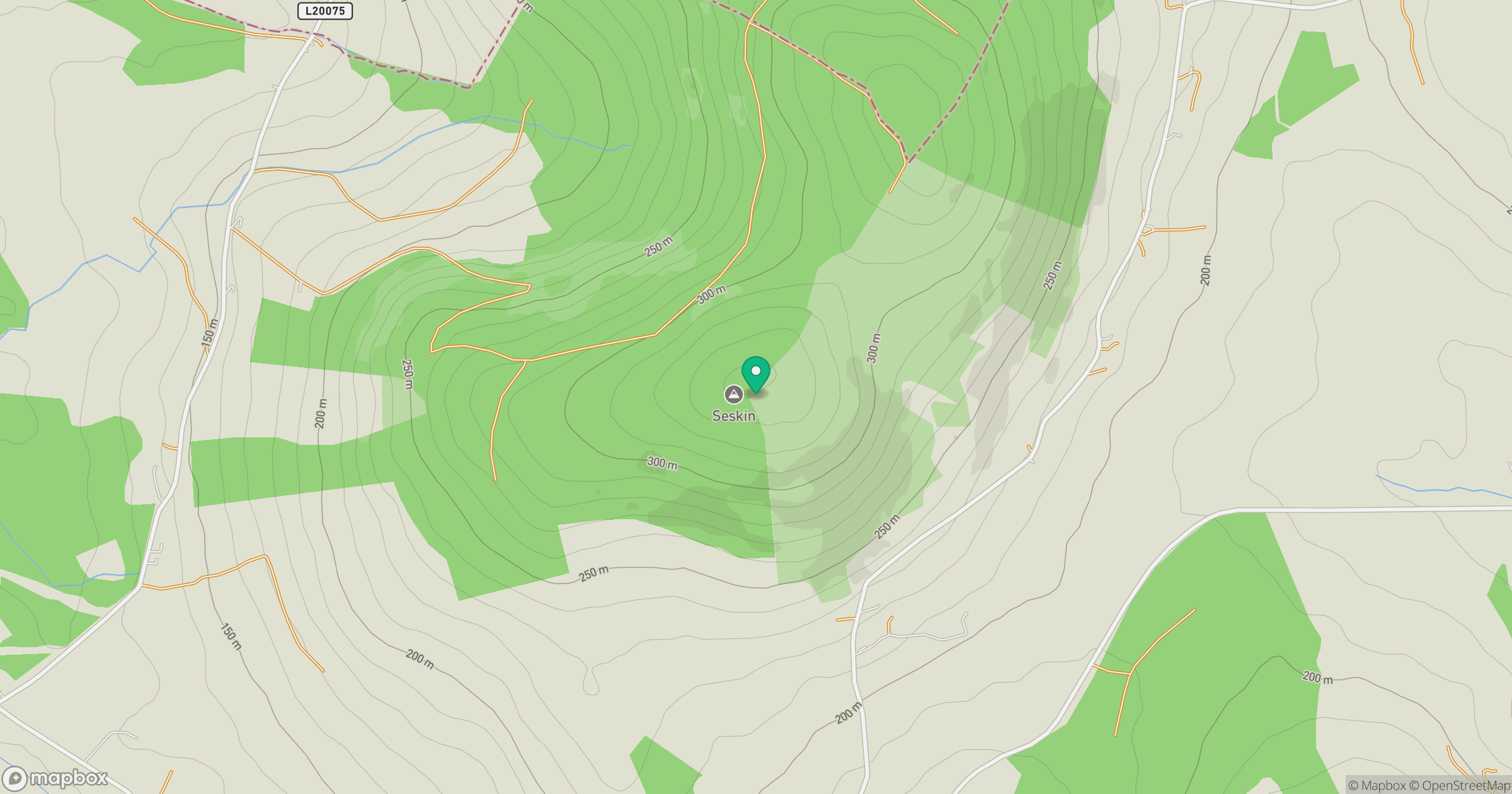
Grid reference: S960727
View on OpenStreetMapOpens a map in a new tab, centred on the hill.
Hills within 30 km
Straight-line distance, not a walking route or confirmation of access.
No comments yet. Be the first.